The History of Eureka Springs, Arkansas
The Eureka Springs Historic District was listed on the National Register of Historic Places on December 18, 1970. It was one of the earliest National Register districts listed in Arkansas and enumeration and documentation of the properties was not completed. At the time the Eureka Springs Historic District was listed on the National Register, the boundaries of the district were those of the city limits. Although since
f 970 the city limits has expanded a number of times, the boundaries of the district remain the same as when originally listed in 1970.

This nomination of the Eureka Springs Historic District is based on a comprehensive architecturn1 survey conducted over a three-year period that documented and cataloged each structure in the boundaries of the National Register district. In order to determine the range and quality of extant architectural resources each property has been reviewed by the Arkansas Historic Preservation Program to determine integrity. The high ratio of non-contributing properties in the district reflects, in large part, construction after 1955. Since the Eureka Springs Historic District was listed on the National Register in 1970, another 1 63 buildings have been constructed, significantly adding to the number of buildings that do not contribute to the district. Although 491 or 51 % of the total number of properties in the district have been determined contributing, the core of the district retains its high ratio of contributing historic properties and it is from this area that the significance of the Eureka Springs Historic District is derived.

Summary
The Eureka Springs Historic District is located in the boundaries of the city at the time the district was originally listed on the National Register of Historic Places in 1970. There are 967 properties in the district of which 49 1 (5 1 %) contribute to the historic significance. The majority of properties in the district are residential, with 101 commercial buildings, five public buiIdings, twelve churches and fifteen natural springs. The district contains 596 buildings constructed before 1955 of which 72% were built prior to 191 0. The overwhelming character of the buildings is derived from the Victorian era. Highly stylized versions of more than twenty different architectural influences are seen in the historic district. Natural elements are a significant part of the uniqueness of the Eureka Springs Historic District where houses and buildings are scattered over mountaintops, clinging to mountainsides, or nestling in the gorges of the city, each constructed uniquely to adapt to its terrain.

I – Elaboration
The Eureka Springs Historic District is located in a small town in the Ozark Mountains of Northwest Arkansas. The district contains a collection of Victorian era buildings and homes, built on steep hillsides with many unusual adaptations to the terrain. The district includes 967 buildings and houses scattered Eureka Springs Historic District throughout the approximate two square mile area of steep mountains and deep ravines. The majority of properties less than fifty years old ate located along U.S. Highway 62 which runs along the top of the mountain on the south side of she city. Of the district” 967 properties, 45% were constructed during the peak of the city’s popularity 1880-1920, Almost 200 buildings were constructed in the I 890s alone, and reflect strong characteristics of the Queen Anne style in varying manners. Although not within the period of significance, the 1 16 buildings in the district that were constructed in the 1960s represent the second period of significant growth in the city based on a new wave of tourists seeking outdoor recreational activities on nearby Me Beaver. Throughout the history of the city, visitors to Eureka Springs have been attracted to the quaint and unusual Victorian era buildings constructed on extreme steep hillsides along winding streets.
Eureka Springs was founded around and because of the natural springs located throughout the area. Early visitors who came seeking the healing pourers of the natural spring waters in the 1830s camped around the springs in tents and wagons or other makeshift shelters. By 1879 when the city was formed, crude wood buildings were constructed, taking the place of tents.
By 1881 when the population of Eureka Springs had grown to 5,000 an article written about the city described, . . .”Everywhere that a human abode could be constructed, houses of every description, tents and shelters, sprang up all over the mountain tops, hanging by corners on steep hillsides, perched upon jutting borders, spanning the gulches, or nestling under crags and in grottoes. It is a most peculiar looking place, presenting aa apparent disregard to anything like order and regularity or arrangement, with its two-story
streets, its winding thoroughfares and circular pathway.”
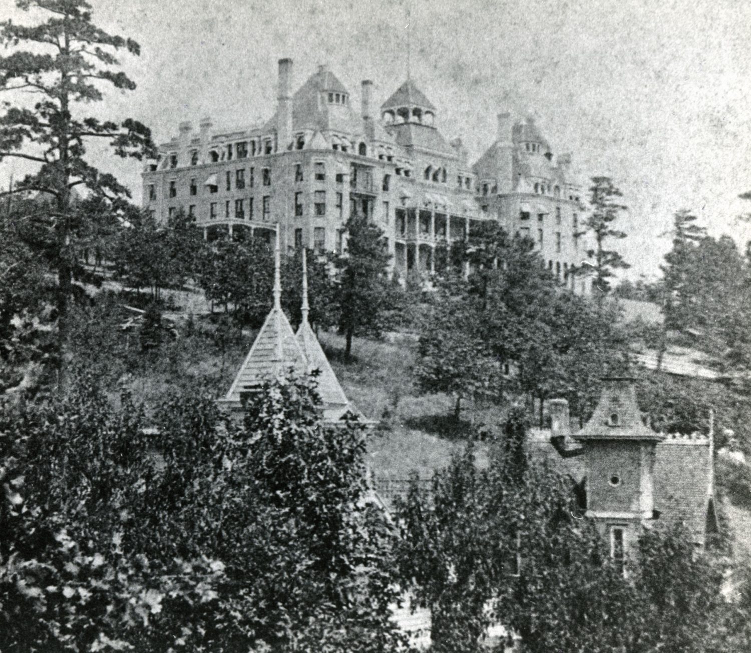
Fire, floods and other natural forces contributed to the demise of most all of the city’s earliest buildings. By the 1880s, new and substantial structures were being built and by the height of the city’s popularity as a Victorian health resort during the 1890s the permanent character of the city was established. The Eureka Springs Historic District conveys a strong sense of time and place as a Victorian Resort. The district contains
examples of popular architectural styles, typical of late l9th and early 20’~ century American building design.
Built along steep mountainsides and in deep ravines, the structures of Eureka Springs present a unique adaptation of building in cohesion with an extreme natural landscape.
Eureka Springs lies in the extremely broken mcl irregular mountains midway between Northwest Arkansas’ Boston and Ozark Mountain ranges. Located 1,700 feet above sea level, the climate of Eureka Springs is considered mild in winter and pleasant in summer. Nine miles from the Missouri state line, Eureka Springs is situated on the headwaters of Leatherwood Creek, a tributary of the White River. Nearby, the Kings River has proved to be an important part of the region’s development due to periodic flooding which virtually
isolated the western part of Carroll County from its county seat to the east of the river.
Establishment of a Eureka Springs Historic District Western district courthouse for Carroll County in Eureka Springs was a direct result of the impact of the Kings River.
Many references to the rugged terrain of Eureka Springs has been made though nicknames such as ”The Town That Climbs The Mountain”, “America” Little Switzerland”, and ‘The Stairstep Town” as buildings and houses in the Eureka Springs Historic District are stacked one behind he other, on twenty steep hills divided by nineteen ravines. The original plat of the city laid out 238 streets and avenues, although a few of them were never opened. Streets were laid out following old paths of the Indians and animals, which had followed the way of least resistance to the old Indian Healing Spring. The buildings that comprise the Eureka Springs Historic District are located on over 100 winding streets in varying shapes like “Ss”, “Vs”, and “os'”.”
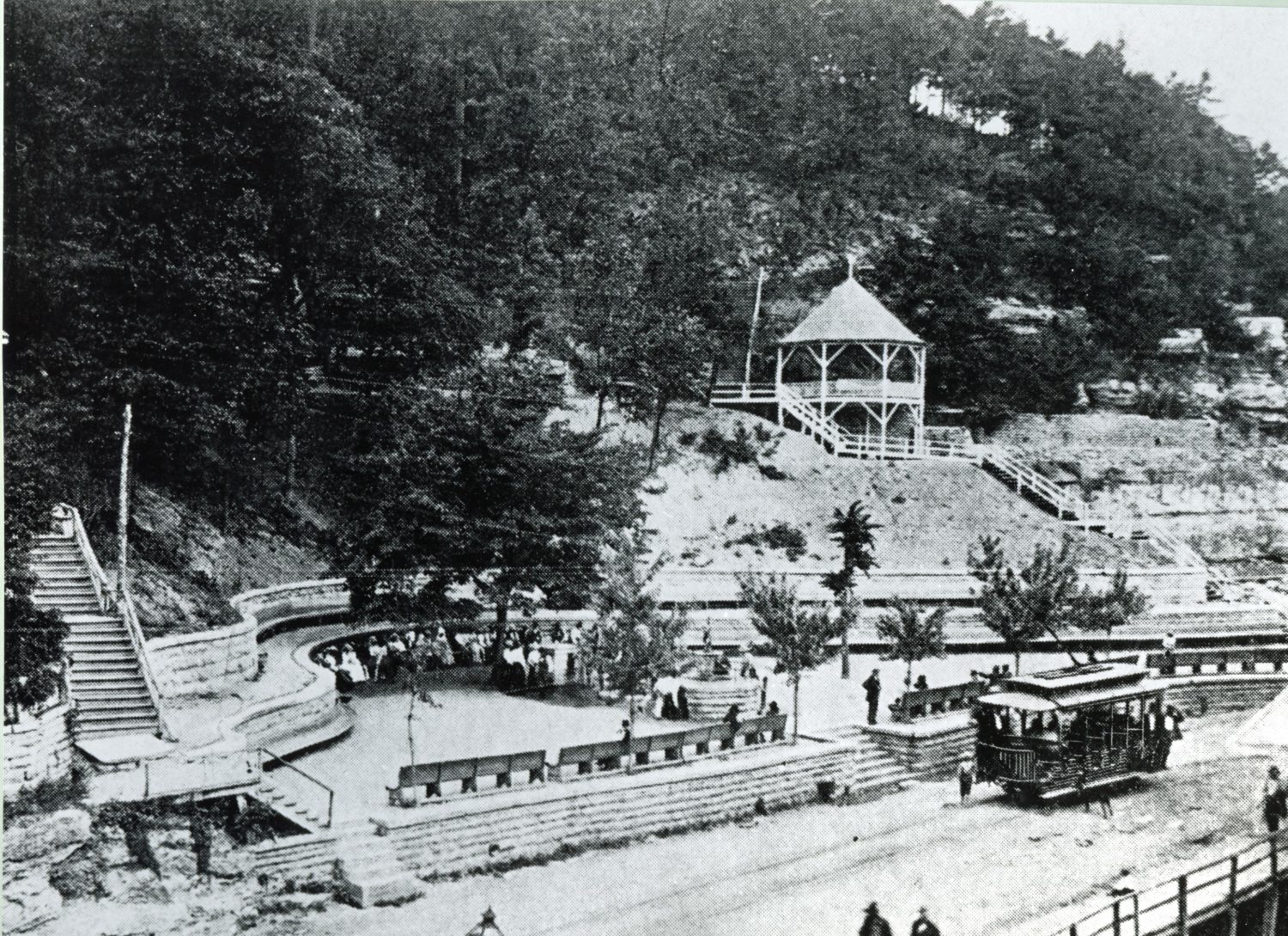
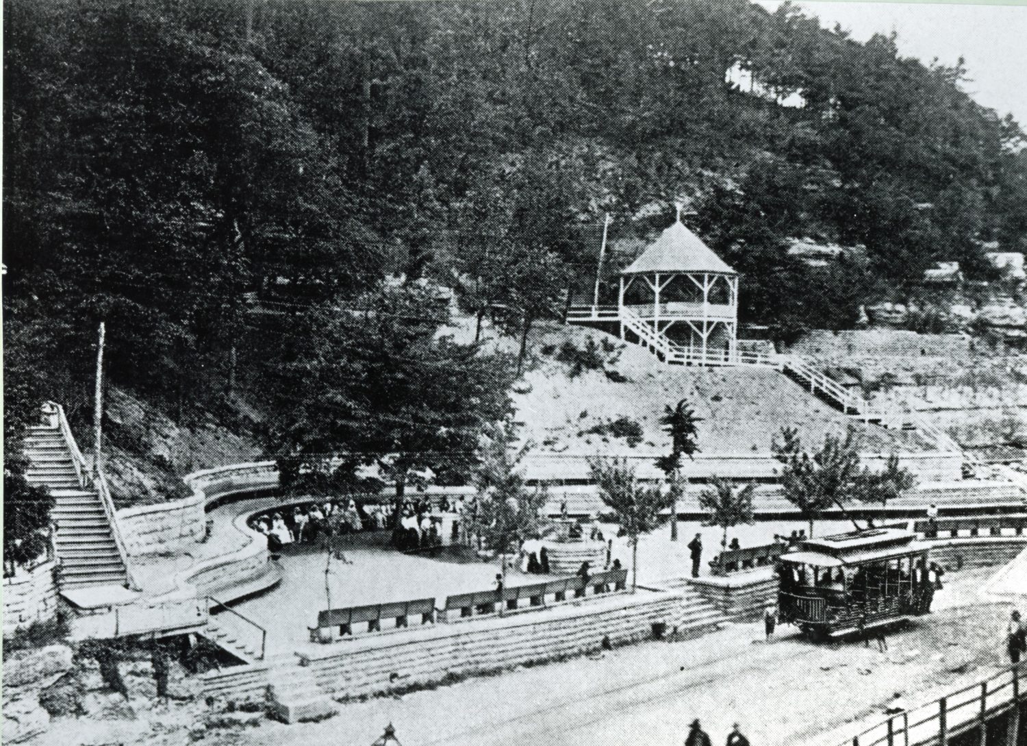
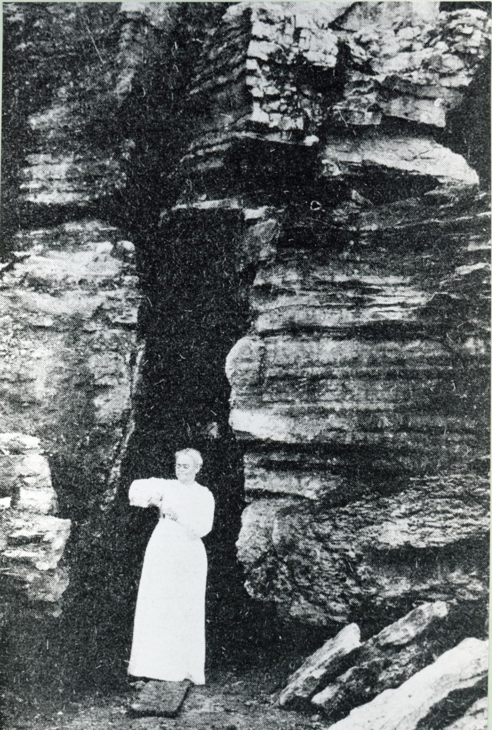
The area is lush with vegetation along its steep hillsides and deep ravines. Natural limestone abounds that has been crafted into circle 8s infrastructure of the city on its streets, sidewalks and walls. Sixty-three springs that were the basis for the establishment of the city emerge from the mountainsides in the city. Permanent settlement developed around the various springs in the area and property values were based on the proximity to the springs. Wealthiest settlers located close to the springs. Twelve of the springs in the district are noted by structures and or landscaping features such as Crescent Spring that features an elaborate Victorian era gazebo, or Grotto Spring with its stairway to a grotto built into the hillside.
The last decades of the 19Ih century through 191 0 was a the of immense growth in the city of Eureka Springs as thousands of people visited the resort town nationally famous for its waters at were said to renew health and strength. Elaborate buildings in the architectural styles popular during the Victorian era were constructed at record rate in this period from 1880 to 1 910. Public improvements included gas lighting for city streets jn 1885 and, a city municipal water system in 1 AR estimated 60,000 cubic yards of native limestone was used to construct walls, sidewalks, and public stairways leading from steep hills to other steep hills in the 1 880s and 1890s.~ Most of these features still exist, including ten flights of public steps in the historic district leading from one street to the next. Of particular note is the stairway called “Jacob’s Ladder” which begins on Jackson Street and comes out on Copper Street, containing more than two hundred steps and connecting three streets. Local stonemason C. A. Stillions initials are seen on the historic concrete benches at Crescent Springs and Sweet Spring.
The ”Historic Imp”, or the old Highway 62 business route was paved in concrete in the 1920s- This original concrete street winds through the district, combining with historic sidewalks and walls. The overall appearance of the Eureka Historic District is greatly enhanced by the use of color on its Frame buildings. Color is an important feature used to highlight the Victorian village character of the district.
Development by Period
1870s
Although four major fires prior to the 1890s destroyed many of the early frame structures that had been hastily constructed, there are three extant houses in the Eureka Springs Historic District dating from the 1870s. Built in 1878, the house at 10 Magnolia is located on n steep hillside overlooking a deep ravine. J3 is two-story frame house features little ornamentation in its simple design. The Eichor House at 14 Breeding was built in 1879 and is the district’s oldest extant Second Empire style. The third building remaining from
the 1 870s is located at 124 Spring Street. Although the house was ‘built in 1 874 and is thought to be the oldest extant building in the district, it has been extensively altered ad does not reflect its original historic appearance.
1880s
The 1880s in Eureka Springs were marked by several disastrous fires that destroyed most of the city’s wooden buildings. Seventy-two buildings constructed in the 1880s remain in the historic district. Largely as a result of the efforts of the Eureka Springs Improvement Company, formed in 1882 for the purpose of improving the living environment of Eureka Springs, the buildings constructed in this era were substantial. It was during this period that most of the city’s infrastructure, including stone walks and walk, were put into
place, providing more stability to the hillsides. Many of the buildings remaining hm the 1880s are of stone construction and the frame buildings are almost all situated on sturdy stone foundations.
1890s
Representing the overall character sf the Eureka Springs Historic District, the 1 90 houses and buildings constructed in the 1890s feature characteristics of high styles of the Victorian era, Second Empire, Romanesque and Queen Anne. The influence of the Queen Anne and Second Empire styles is seen mostly on houses in the district, while the architecture of the historic commercial buildings heavily incorporates details of the Italianaate and Romanesque styles into their designs.
1960-1921s
Continuing to be a popular health resort, the turn of the century saw steady growth, parallel to that of the 1 890s. There axe 120 buildings in the historic district that were constructed in the years between 1900 and 1910. Another fifty buildings in the district had been constructed by 1920. By that year 45% of all of the buildings in the Eureka Springs Historic District had been constructed.
1920
Although the economy of Eureka Springs suffered a loss of visitors after the Federal Government began regulating medicines, opening of an auto path into Eureka Springs in 1920 brought a new type of visitor, the motorist. Many of the seven-six buildings in the district that were constructed in these two decades relate to the automobile tourist such as the early tourist cabins, and filling stations.
1950-1970
The 1950s saw a renewed interest in Eureka Springs as the family vacation via automobile became a popular activity and related development on Highway 62 took place. The largest period of path in Eureka Springs since its heyday from 1.880 to 191 0 occurred in the 1960s. Development of a large recreational lake nearby, promotion of the spectacular scenery of the ozark Mountains and the construction in 1968 of a seven-story figure of Jesus known as “Christ of the Ozarks’ and its accompany site with daily live performances of the Great Passion Play, spurred a large and diverse tourist market in this period of the district’s history. The city enjoyed a continued renewal as a tourist attraction as more and more people discovered the small Victorian city built In varying odd situations on steep hillsides. Beginning in the 1960s a new generation of artists moved to Eureka Springs and recognition of the historic significance of the city”
The majority (87%) of the 967 properties in the Eureka Springs Historic District were built as residences. The historic district contains 10 1 commercial buildings, twelve churches, five public buildings and fifteen springs with varying types of features such as gazebos, grottos, and elaborate landscaping.
